Hurricane Joaquin, the tenth named storm of the season, has strengthened in the Atlantic Ocean. It currently has winds of 85 mph, located 190 miles east-northeast of the Central Bahamas and is moving southwest at 6 mph, according to the National Hurricane Center.
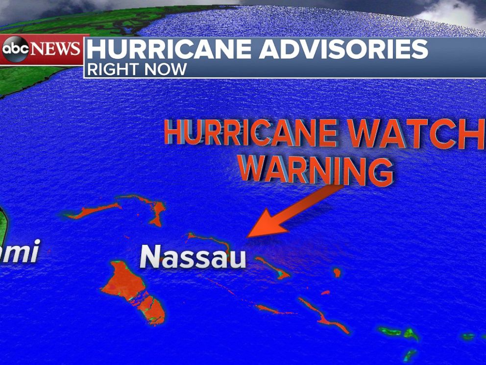
Hurricane warnings have been posted for the Central Bahamas, and a hurricane watch is issued for the Northwestern Bahamas. These islands can expect hurricane conditions starting by Thursday morning. A storm surge of 2 to 4 feet above sea level will occur, and waves will be large and dangerous along the coast. Five to 10 inches of rainfall can be expected over the central Bahamas, but some rain totals may reach 20 inches in the islands of San Salvador and Rum Cay, where Joaquin will sit over for the next two days. Lesser amounts of 2 to 5 inches will fall in the southeastern and northwestern Bahamas.
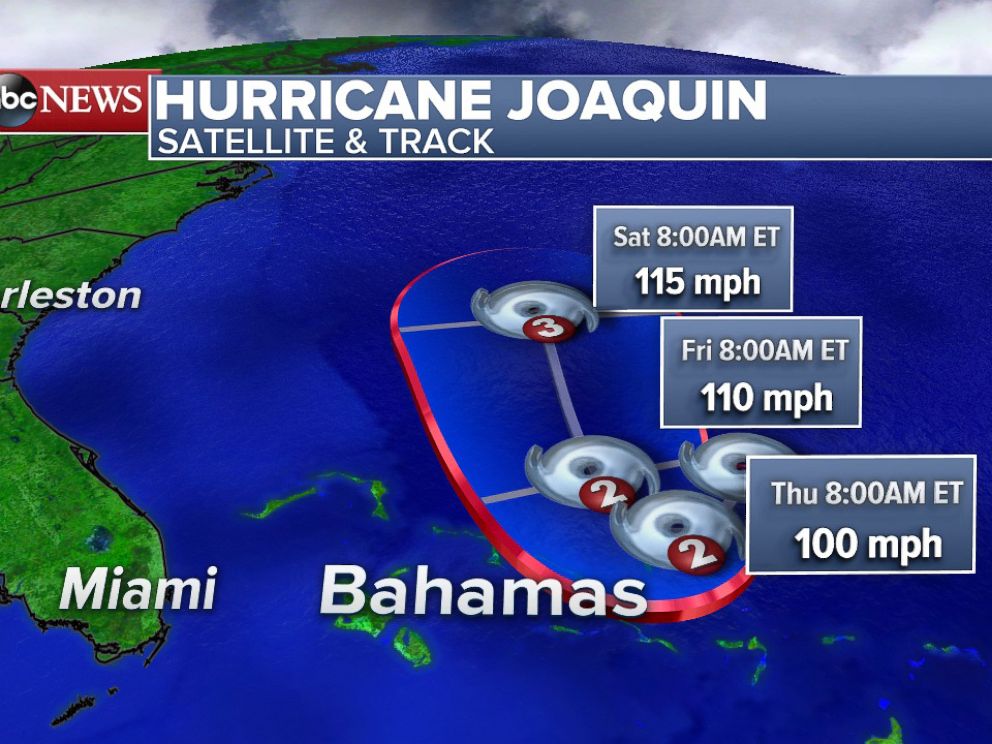
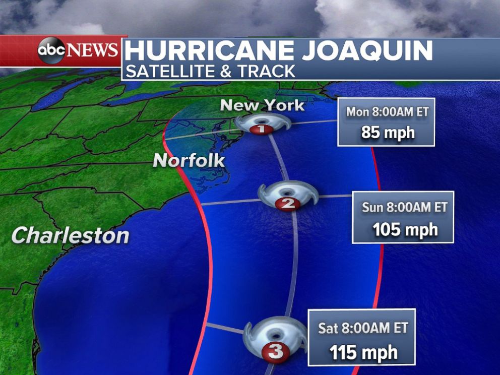
Joaquin is expected to linger over the eastern Bahamas through Friday as a hurricane. Overnight Friday into Saturday morning, the unusually warm waters is expected to allow Joaquin to strengthen into a category 3 hurricane with 115 mph winds as it starts to turn north. After this northerly turn, the path becomes uncertain through the rest of weekend as it interacts with a trough over the eastern United States.
“Confidence in the details of the track forecast late in the period remains low,” the National Hurricane Center said. “A wide range of outcomes is possible, from a direct impact of a major hurricane along the U.S. East Coast to a track of Joaquin out to sea away from the coast.”
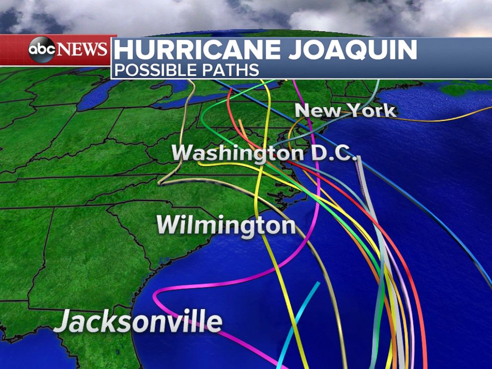
It is still too early to determine the exact impacts that Joaquin may or may not have on the United States, but regardless of the final track that Joaquin takes, a surge of tropical moisture is expected to drench the East Coast, bringing several more inches of rain to an already soaked region.